
Karachi may be spared from the worst of Cyclone Biparjoy, the latest trajectories of the tropical storm seem to suggest.
“The very severe cyclonic system (VSCS) Biparjoy will not directly hit Karachi; however, it will certainly hit Keti Bandar,” Minister of Climate Change Sherry Rehman said on Tuesday.
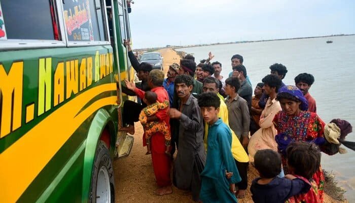
Senator Sherry Rehman warned on a private TV show that there is no other option but evacuation for the residents of Keti Bandar.


She added that Karachi may experience light rainfall today, but heavy rainfall is expected on Thursday and Friday. Karachi is likely to receive 110mm of rainfall, while Thatta, Badin, and Sajawal are expected to receive 330mm of rain.
Sherry Rehman said panic is natural, pointing out that it is human psychology to panic when danger is near. However, following safety precautions can help us avoid danger.
The Ministry of Climate Change has issued a High Alert for the residents of Keti Bandar and initiated the evacuation process.
The senator urged locals to cooperate with the government and emphasized that the government did not want to resort to force, but if residents did not follow the SOPs (Standard Operating Procedures), necessary action would be taken.
“We have a red alert in place until June 18 and will issue a new advisory at 11 or 12 o’clock on the day the storm is expected to make landfall,” she added.
In a separate tweet, she stated: “Panic is understandable, human nature; but it’s important to move with caution and calm.”
“Evacuations are painful, stressful, and hard to embark on, but we must insist on them in areas where we see #CycloneBiparjoy making landfall. For coastal areas like Keti Bandar, evacuations are not optional.”
During the same appearance on Geo News’ ‘Aj Shahzeb Khanzada Ke Saath,’ Pakistan Meteorologist Department (PMD) Sindh Chief Meteorologist Sardar Sarfaraz said the storm’s intensity had somewhat decreased.
“There is no dangerous situation in Karachi; the cyclone will exit from the city’s south,” he said.
He further added that the storm was heading toward the north.
“It will then move northeast, where it will hit or pass Keti Bandar and Indian Gujarat,” he said, commenting on the cyclone’s trajectory.


