
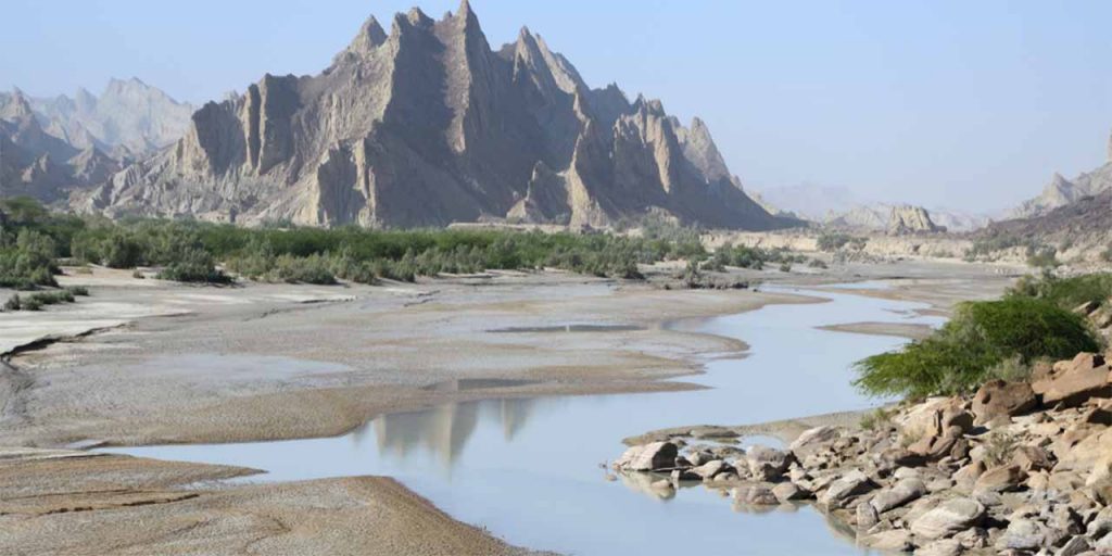
The National Aeronautics and Space Administration (NASA) has shared satellite images of the Hingol National Park, located 120 miles from Karachi. The image was acquired in February this year.
Read more – NASA shares picture of snow-covered Himalayan ranges from space
Nasa Earth observatory describes Hingol Park with its “rocky terrain, mountain caves, and beautiful beaches” as “one of the natural wonders of Pakistan”.


Hingol spans around 6,200 square kilometres (2,400 square miles) across three districts of the Balochistan Province: Lasbela, Awaran, and Gwadar,.
The park is named after the Hingol River, which flows through this dry region year-round and is the longest in Balochistan. Before emptying into the Arabian Sea, the Hingol flows into an estuary that supports threatened fish, birds, and crocodiles. It is part of the largest national park for the protection of endangered species in the country. The park is also home to wild Sindh Ibex, Balochistan Urial, and Chinkara Gazelle.
Located approximately 200 kilometers (120 miles) northwest of Karachi, Hingol National Park features several distinct ecosystems. In the north, it includes an arid subtropical forest, while dry, mountainous terrain covers the western portion.
In the east, the park is renowned for a group of mud volcanoes that spew methane and mud instead of lava. Along the coast, Hingol includes caves, beaches, and a marine ecological zone that is home to dolphins, sea turtles, and mangroves. The water body in the image above is an ephemeral lake near Sapat Beach.

The park also holds a significance amount for Hindu community because of the Hinglaj Mata Mandar located there.


